
- Details
Our group started a new collaboration with the GSSS Institute of Engineering and Technology for Women in Mysore, Karnataka, India, on the occasion of the IEEE-accredited conference ICEECCOT-2021, planned for 11-12th Dec 2021. Fabio Dell'Acqua will be part of the Technical committee and will assist with organization of the conference. This is a further step in expanding our network of collaboration in India, which now accounts several academic and research institutions.
More details can be found at the conference web site: http://iceeccot.geethashishu.in/indexn.html#cs1
The deadline for paper submission is 30th of September, 2021.
- Details
We are proud to announce that our coordinator prof. Paolo Gamba has received the 2021 IEEE GRSS Outstanding Service Award during the Opening Ceremony of the 2021 IEEE GRSS Symposium (IGARSS 2021) on Monday, July 12th. The award is assigned annually to GRSS members who distinguish themselves by giving exceptional contributions to the progress of the Society. Prof. Gamba has recently ended his term as GRSS President, and as a past-president he still holds a key role in the Society and continues pursuing its objectives of benefiting society through science, engineering, applications, and education in remote sensing and geosciences.
IGARSS is probably the largest conference in the remote sensing scientific community, held annually at different locations across the globe. This year it was planned in Brussels, Belgium, but concerns for the pandemic situation convinced the organizers it to move it to a full-online format.
- Details
The ITAREO (ITalo-ARgentine Earth Observation technologies for the mapping of indicators for the United Nations Sustainable Development Goals) project was created to assess the usefulness of satellite images in obtaining geospatial information to verify the stage of achievement of the United Nations’ sustainable development goals (United Nations Sustainable Development Goals).
ITAREO is a Project of Great Relevance funded by the Italian Ministry of Foreign Affairs and International Cooperation as part of the collaboration between Italy and Argentina for the three-year period 2021-2023. The project, which had been postponed due to the pandemic, is coordinated by prof. Paolo Gamba, and it finally started a few days ago.
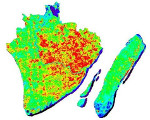
The project team includes not only researchers from the University of Pavia, but also scholars from the University of Rome ”La Sapienza” and the University of Molise. In its initial stage, the project will analyze satellite data from the SIASGE constellation (Italian-Argentinian Satelite System for Emergency Management) and the Copernicus program of the European Space Agency, providing characterization maps of urban areas and agricultural crops in selected areas of the two countries concerned. The project is in fact supported both by CONAE (Comision Nacional de Actividades Espaciales, the Argentinian space agency) and by ASI (Italian Space Agency).
- Details
Prof. Dara Entekhabi is Full Professor of Remote Sensing at the Department of Earth, Atmospheric and Planetary Sciences, Massachusetts Institute of Technology. He is also the Science Team Leader of the NASA Soil Moisture Active Passive (SMAP) Satellite Mission. In May-June 2018 he visited our lab in the framework of the "Boston Project", set up by our university to tighten academic links between Pavia and Universities of the Boston area in the USA. During his visit he gave a series of lectures on combined active and passive microwave remote sensing within the Radar Remote Sensing course. His lectures and the consequent interaction sparked a long-term collaboration, which involved thesis work and joint research. Erica Albanesi and Silvia Bernoldi continued working actively on the subject in cooperation with prof. Dell'Acqua and prof. Entekhabi even after their graduation in Electronic Engineering in spring 2020. After a series of conference publications, their work finally made it to a journal paper:
Albanesi, E.; Bernoldi, S.; Dell’Acqua, F.; Entekhabi, D. Covariation of Passive–Active Microwave Measurements over Vegetated Surfaces: Case Studies at L-Band Passive and L-, C- and X-Band Active. Remote Sens. 2021, 13, 1786. https://doi.org/10.3390/rs13091786
The paper is published "open access" and can be seen by clicking on the above link.
- Details
The paper "Experimental data set analysis of RSSI‐based indoor and outdoor localization in LoRa networks" by the TLC&RS Lab is a Top Cited Article of the Wiley Internet Technology Letters in 2019-2020.
The dataset used in this work has been included in the 2020 GitHub Archive Program. Details of the paper and dataset follow:
- Goldoni, L. Prando, A. Vizziello, P. Savazzi, P. Gamba, “Experimental data set analysis of RSSI‐based indoor and outdoor localization in LoRa networks,” Wiley Internet Technology Letters, 24 September 2018, https://doi.org/10.1002/itl2.75.
- Dataset link: https://github.com/emanueleg/lora-rssi
- GitHub Archive Program link: https://archiveprogram.github.com/