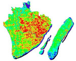
The ITAREO (ITalo-ARgentine Earth Observation technologies for the mapping of indicators for the United Nations Sustainable Development Goals) project was created to assess the usefulness of satellite images in obtaining geospatial information to verify the stage of achievement of the United Nations’ sustainable development goals (United Nations Sustainable Development Goals).
ITAREO is a Project of Great Relevance funded by the Italian Ministry of Foreign Affairs and International Cooperation as part of the collaboration between Italy and Argentina for the three-year period 2021-2023. The project, which had been postponed due to the pandemic, is coordinated by prof. Paolo Gamba, and it finally started a few days ago.
The project team includes not only researchers from the University of Pavia, but also scholars from the University of Rome ”La Sapienza” and the University of Molise. In its initial stage, the project will analyze satellite data from the SIASGE constellation (Italian-Argentinian Satelite System for Emergency Management) and the Copernicus program of the European Space Agency, providing characterization maps of urban areas and agricultural crops in selected areas of the two countries concerned. The project is in fact supported both by CONAE (Comision Nacional de Actividades Espaciales, the Argentinian space agency) and by ASI (Italian Space Agency).


