- Details
The 7th International Conference on Computer Vision & Image Processing (CVIP-2022), a premier annual conference focused on Computer Vision and Image Processing will be held on November 04-06, 2022. CVIP-2022 conference is being organized by Visvesvaraya National Institute of Technology Nagpur (VNIT Nagpur), Maharashtra, INDIA. CVIP 2022 is endorsed by the International Association for Pattern Recognition "IAPR". The proceedings of CVIP will be published in Springer Series on Communications in Computer and Information Science (CCIS) Springer.
The conference website is available at: https://vnit.ac.in/
Prof. Fabio Dell'Acqua will be a keynote speaker at the conference.
- Details
New paper: Yanzi Shi, Jiaojiao Li, Yunsong Li, Paolo Gamba, Hyperspectral Target Detection Using a Bilinear Sparse Binary Hypothesis Model, IEEE Transactions on Geoscience and Remote Sensing
Abstract: The binary hypothesis testing (BHT) is one of the most important models in hyperspectral target detection (HTD). However, this model is generally based on linear mixture model (LMM), and might be inaccurate to reflect target and background characterizations in some scenes. This paper presents a bilinear sparse target detector (BSTD) by applying bilinear sparse mixture model (BSMM) to a popular BHT-based detection algorithm termed adaptive matched subspace detector (AMSD), which takes bilinear target-background interaction and sparse abundance into account. Moreover, as AMSD relies heavily on background subspace, we design a robust background subspace construction method. Specifically, we first classify each pixel into noise, border, or other particular instances according to its density, which is measured by jointly spatial-spectral distance. With the coarse classification map, a class-guided automatic background generation (CABG) process is introduced to reliably generate pure background samples. Detection statistics and component analysis on five real-world hyperspectral images verify the effectiveness of our BSTD method.
The pdf of the paper is available at https://ieeexplore.ieee.org/document/9638495
- Details
- Details
David Marzi and Paolo Gamba have just published a new paper, entitled "Inland Water Body Mapping Using Multitemporal Sentinel-1 SAR Data", in IEEE Journal of Selected Topics in Applied Earth Observations and Remote Sensing (JSTARS).
This work addresses the importance of water bodies monitoring and mapping using SAR satellite data in the context of climate change studies. Indeed, analyzing changes over time of this precious land cover type in terms of extent and/or transition towards other classes, is essential for the characterization of climate and, thus, for the whole climate change community.
By leveraging the astonishing computational power of Google EarthEngine, we developed a fully automated system exploiting Sentinel-1 aimed at analyzing wide geographical areas located anywhere in the World. It generates high-resolution water bodies maps by applying a totally unsupervised approach to sequences of Sentinel-1 SAR data in just a matter of minutes.
The journal is 100% open access, which means that the whole article content is freely available and downloadable at this link.
- Details

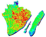
During an event on October at the Italian Pavillon at Expo2020Dubai, researchers from the University of Pavia, Napoli Parthenope and CNR-IREA presented cutting edge EarthObservation technologies based on radar and multi- and hyperspectral sensors. Among these, methodologies aimed at recognizing the presence, type and abundance of particular construction materials were presented: https://lnkd.in/eGQxH2Mn
This web app was developed by David Marzi from our lab using GoogleEarthEngine, you will be able to see color composites, investigate abundance maps of the main construction materials that are used in the urban area of Dubai (e.g., concrete and metals) and inspect some interesting vegetation indices (e.g., NDVI and #EVI), just by clicking on the different layers in the interactive panel. Finally, if you click wherever you like in the City, you will be able to see in real time the spectral signature of the clicked location, generated based on the hyperspectral data from the Italian mission PRISMA.
Give it a try, and enjoy the spectral exploration of Dubai ;-)


