


David Marzi and Paolo Gamba have just published a new paper, entitled "Inland Water Body Mapping Using Multitemporal Sentinel-1 SAR Data", in IEEE Journal of Selected Topics in Applied Earth Observations and Remote Sensing (JSTARS).
This work addresses the importance of water bodies monitoring and mapping using SAR satellite data in the context of climate change studies. Indeed, analyzing changes over time of this precious land cover type in terms of extent and/or transition towards other classes, is essential for the characterization of climate and, thus, for the whole climate change community.
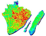
By leveraging the astonishing computational power of Google EarthEngine, we developed a fully automated system exploiting Sentinel-1 aimed at analyzing wide geographical areas located anywhere in the World. It generates high-resolution water bodies maps by applying a totally unsupervised approach to sequences of Sentinel-1 SAR data in just a matter of minutes.
The journal is 100% open access, which means that the whole article content is freely available and downloadable at this link.